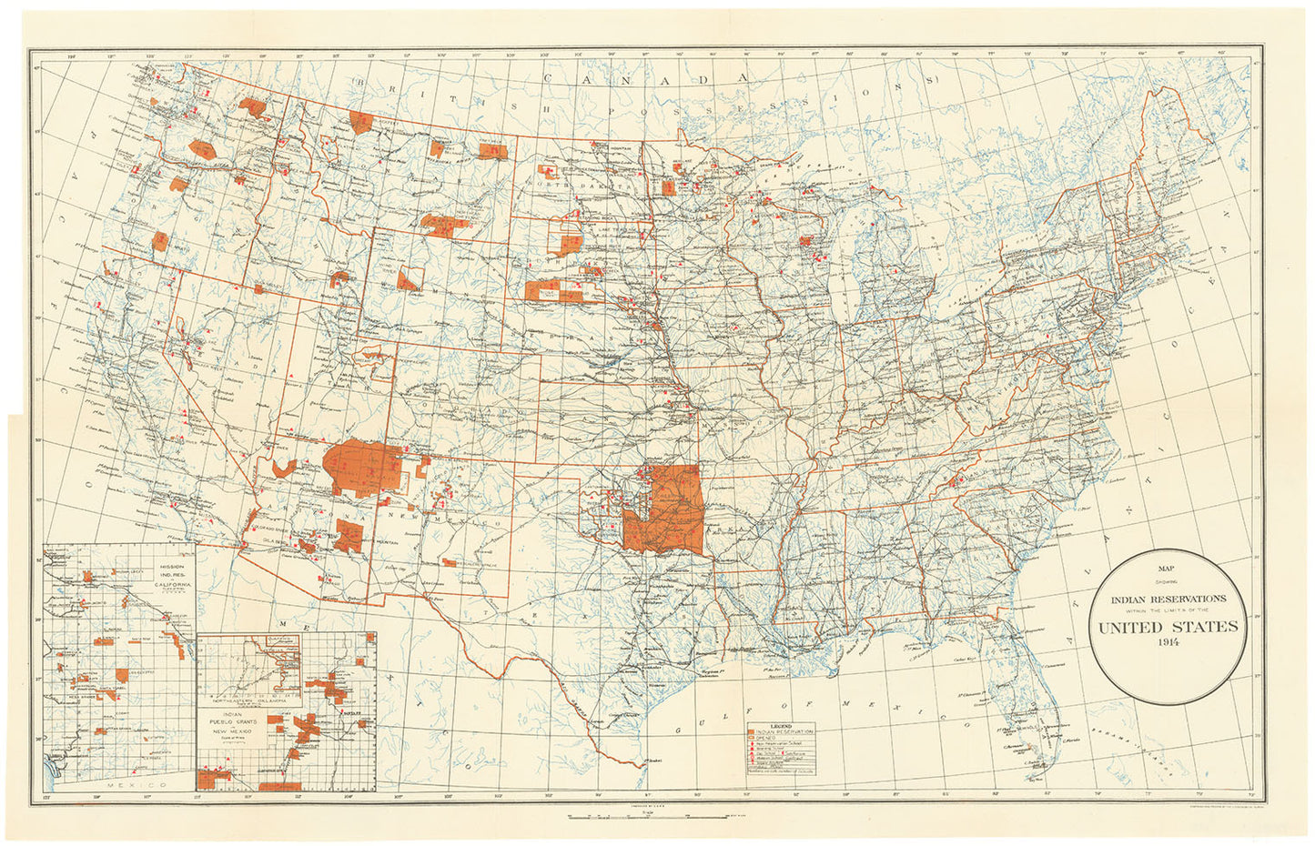
Map showing Indian reservations within the limits of the United States, 1914.
Map showing Indian reservations within the limits of the United States, 1914.
Year : 1914
15 x 24 1/4" (38 x 61.7 cm) plus margins.
This map, engraved and published by the U.S. Geological Survey, displays the boundaries of Native American reservations across the continental United States. It includes detailed information such as reservation hospitals, schools, railroads, state boundaries, cities, major towns, and various types of Indian schools, including American Indian boarding schools, as noted in the legend. Inset maps highlight the Mission Indian Reservations in California, Indian Pueblo grants in New Mexico.
Regular price
$135.00
Regular price
Sale price
$135.00
Unit price
per
Couldn't load pickup availability
Artwork Information
Artwork Information
Shipping and Taxes
Shipping and Taxes
Have questions about this artwork? Our art specialists are here to help Contact Us
For more information, contact us or visit our FAQs page.
View full details